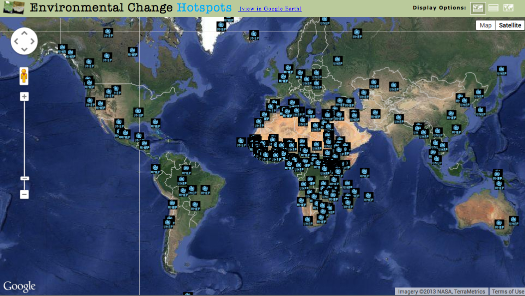
As changes to ecosystems and the environment continue to occur in response to growing population pressure and natural processes, ways to measure and observe these changes on a regular basis will become increasingly important. Satellite imagery offers an important method to provide evidence of such changes and connect local changes to wider audiences. The staff at the United Nations Environment Programme (UNEP) Global Resource Information Database (GRID) Sioux Falls Office has developed and employed a dynamic administrative tool that enables easy upload of satellite images and related storylines, including ground photos, to the GRID Sioux Falls Web site (http://na.unep.net/). This tool enables the continuation of monitoring impacts of environmental change across the globe. The environmental change images feature a time series of two or more satellite images (the Landsat series of satellites is most often used to create change pairs) to demonstrate positive or negative large-scale local environmental changes; each location is referred to as a “hotspot.” Satellite images of these hotspots, accompanied by a short storyline and ground photos, serve as an important method for communicating environmental changes and their impacts to the international community. These hotspots can also function as a unique decision-support tool for policy and decision makers.
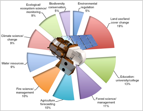
The environmental change hotspots identified by UNEP have enabled scientists, decision makers, and the general public to visualize changes related to land use, deforestation, reduction in glacier extent in mountainous zones and polar regions, impact of diversion of water sources for irrigation, ensuing impacts due to introduction of resource extraction activities, efforts of reforestation, and many more environment-related issues. Recent uses of Landsat imagery align closely with the range of UNEP’s hotspots visualization coverage. Hotspot images illustrate changes over millions of hectares of land and coastline spanning more than 100 countries and all seven continents.
http://na.unep.net/atlas/google.php.

Primary uses of Landsat as recorded by the USGS from October 1, 2012, to October 31, 2013. Source: Adapted from USGS 2013; visualization by United Nations Environment Programme/Global Resource Information Database – Sioux Falls.

Screenshot of the environmental change hotspots page. Source: United Nations Environment Programme/Global Resource Information Database Web site

