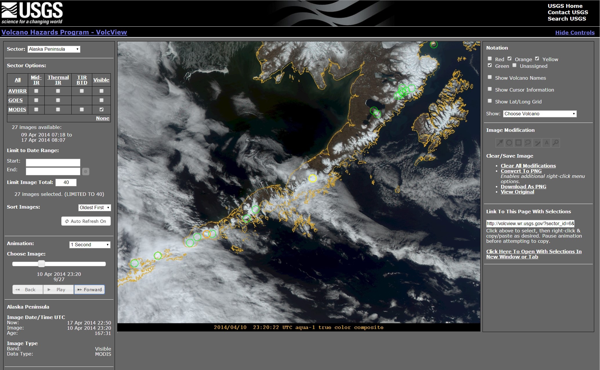
Volcanic ash poses a serious hazard to aviation, and the proximity of the 52 historically active volcanoes in Alaska to North Pacific air routes requires that the Alaska Volcano Observatory (AVO) use all available tools to monitor volcanic activity, detect eruptions, and work with the National Weather Service (NWS) to characterize and track volcanic ash clouds. Satellite remote sensing is used in conjunction with in situ seismic and other geophysical monitoring (at 28 volcanoes) to meet this mission mandate. The AVO uses a variety of near-real time data sources from the Advanced Very High Resolution Radiometer (AVHRR), Moderate Resolution Imaging Spectroradiometer (MODIS), and Geostationary Operational Environmental Satellite (GOES) sensors. During FY13, AVO worked with a Web developer to produce a display and analysis tool for these data. VolcView (http://volcview.wr.usgs.gov) allows AVO staff access to up-to-date image products of the North Pacific while at the office, at home, and via smartphone. Partner agencies like the NWS, Federal Aviation Administration (FAA), and Department of Defense (DoD), as well as the general public, can access the image products to observe and monitor volcanic activity. Data products have been developed by AVO to discriminate volcanic ash from meteorological clouds and to highlight volcanoes with elevated surface temperatures. The AVO is actively engaged with the NWS to improve the analysis and visualization capabilities of VolcView, and the overall goal of the VSC development is to extend the VolcView model to the other four USGS volcano observatories that include the California Volcano Observatory, Cascades Volcano Observatory, Hawaiian Volcano Observatory, and Yellowstone Volcano Observatory.

Interface to VolcView, a tool for display and analysis of satellite images of volcanoes in the North Pacific.

