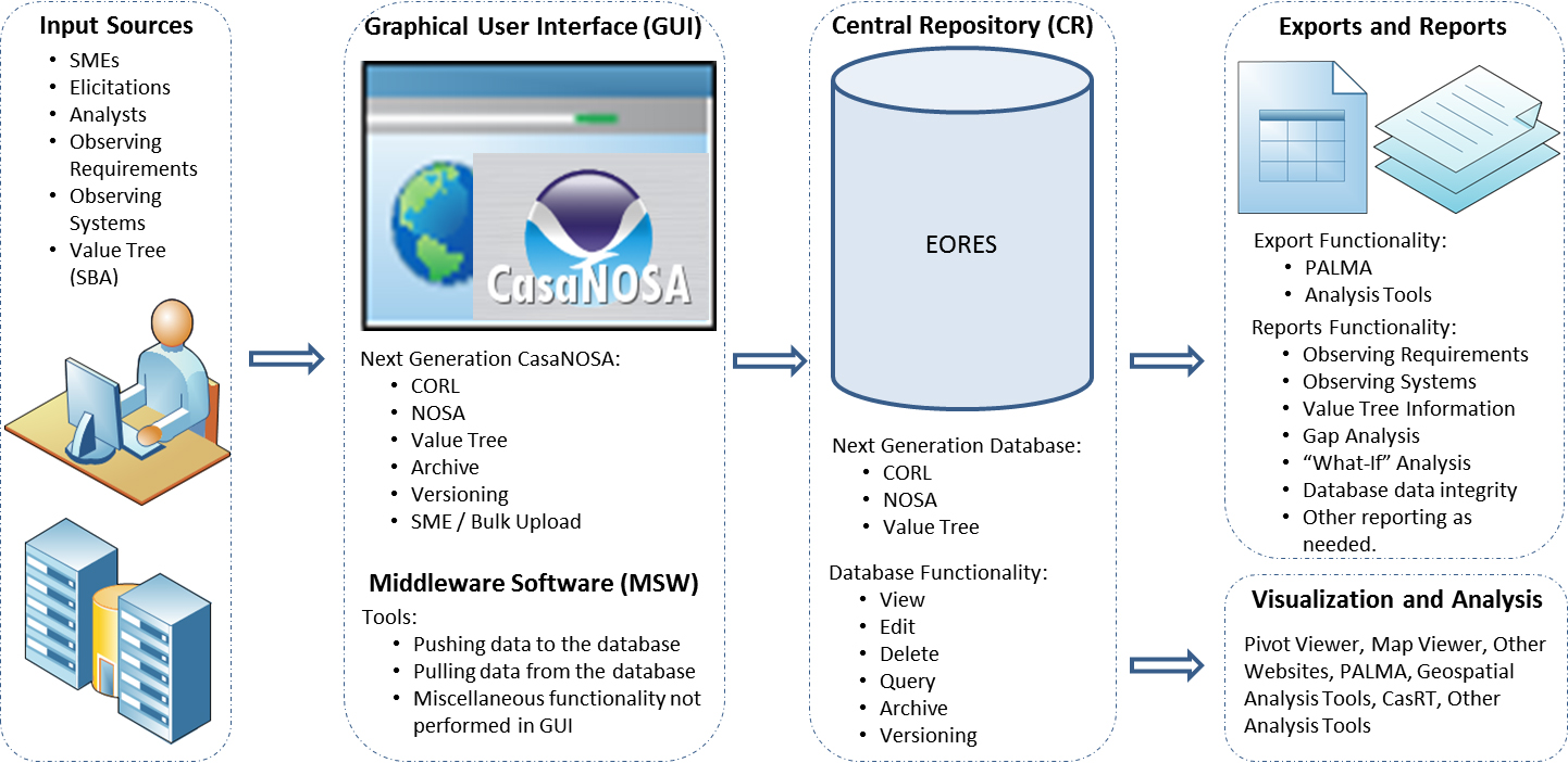
The USGS initiated the National Land Imaging Requirements (NLIR) Project as a collaborative effort between the USGS Land Remote Sensing Program, the USGS EROS Center, and National Oceanic and Atmospheric Administration (NOAA). Under this project, the USGS and NOAA have partnered to design and develop a system to obtain, characterize, manage, maintain, and prioritize user requirements for Earth Observation (EO) data. The comprehensive insight afforded by this capability will enable an unprecedented view of requirements and allow effective matching of EO capabilities and data to user needs.
Rather than defining needs in terms of a particular technology or solution, as has historically been the case, the NLIR Project gathers user requirements for specific EO information such as land surface temperature, land surface topography, and vegetation type. Each requirement includes relevant attributes that define where, when, and at what spatial and temporal resolution the information is needed. Through this approach, user requirements become “solution agnostic” and can be evaluated against all potential solutions including existing and future technologies. The NLIR Project is changing the paradigm for analyzing EO science requirements and linking them to solutions.

An overview of the Earth Observation Requirements Evaluation System.

