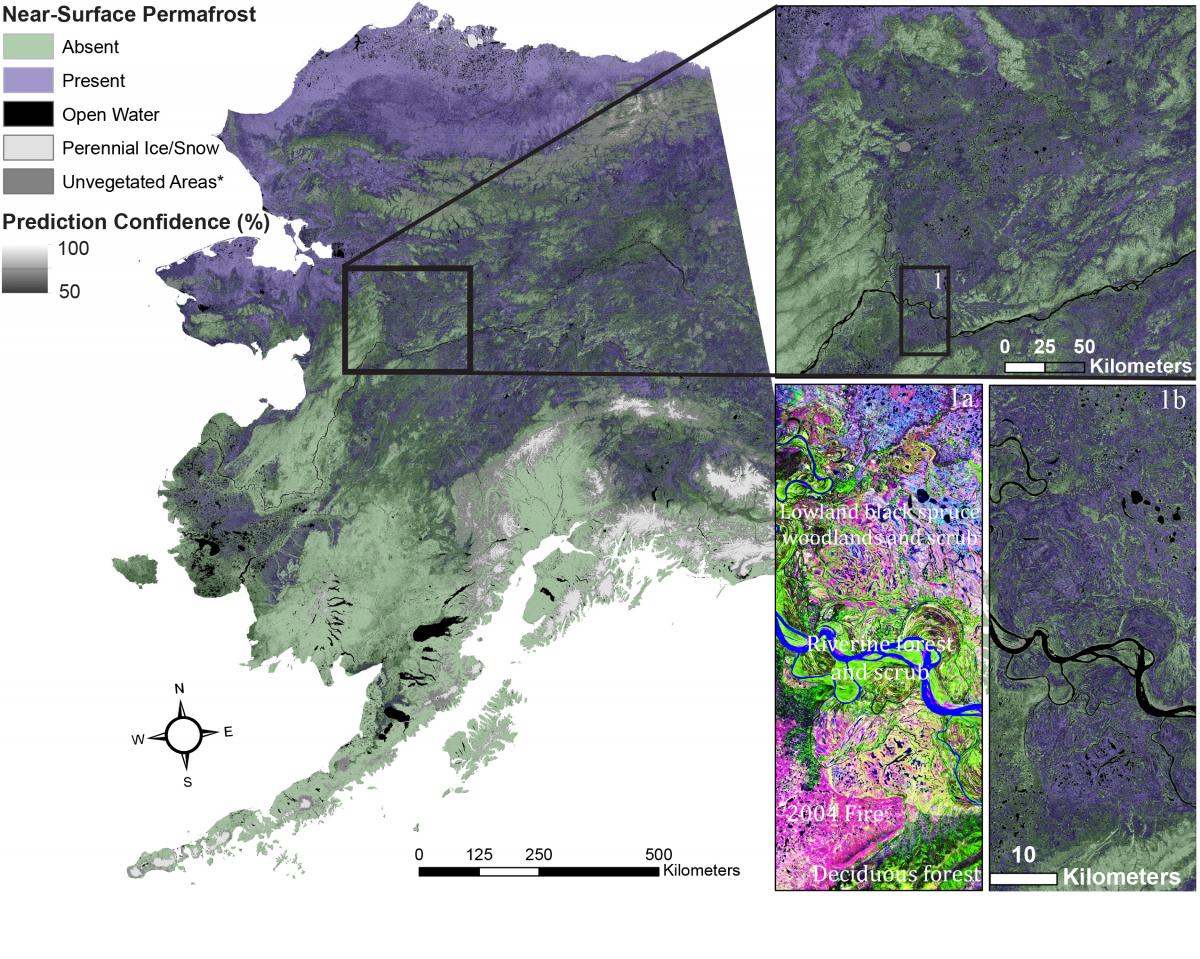
High-latitude systems are experiencing climate change at faster rates than the rest of the globe. Warming temperatures could have dramatic effects on two important high-latitude ecological features: permafrost and soil organic thickness. Near-surface permafrost has a huge effect on surface and subsurface water flows and also sequesters carbon, which could become vulnerable to atmospheric emission with permafrost melting and degradation. A thick soil organic layer constitutes an important carbon stock and an important ecological driver: it insulates permafrost from warming effects and favors forest long-term succession toward spruce forests. Thin soil organic layers, which are often a consequence of wildfires, facilitate permafrost degradation and a progression toward long-term, predominantly deciduous (birch and aspen) forests.
These two ecological drivers, permafrost and soil organic layer thickness, are often crudely mapped because the belowground features are hard to quantify across the landscape. USGS researchers are addressing this data gap by leveraging regression tree and decision tree data mining algorithms to derive complex mapping algorithms driven by Landsat imagery, elevation and derivatives, climate, surface geology, and other spatial data. Reference data consist of soil survey pedon data, shared soil data, and collected soil observations in rural Alaska. Various map products have been produced for the Yukon Flats ecoregion (active layer thickness – maximum thaw depth), the Yukon River Basin (soil organic layer thickness and near-surface permafrost), and Alaska-wide (soil organic layer thickness and near-surface permafrost). As part of a successful National Aeronautics and Space Administration (NASA) Arctic-Boreal Vulnerability Experiment (ABoVE) proposal, USGS resouces will be used to 1) produce more localized permafrost maps in project intensive study sites, 2) extend permafrost mapping into northern Canada, and 3) use electrical resistivity tomography transects to quantify localized permafrost dynamics, understand fire impacts of permafrost, and improve postfire permafrost and soil organic layer mapping.
This project contributed to the LandCarbon Alaska national assessment publication, leading Chapter 3, which assessed available spatial products of soil carbon and permafrost for consistency and agreement with process-based estimates across Alaska. The quantitative modeling approach generated regional near-surface permafrost maps that provide essential information for resource managers and modelers to better understand near-surface permafrost distribution and how it relates to environmental factors and conditions.
URL http://lca.usgs.gov/lca/alaskapermafrost/index.php

Near-surface permafrost (within 1 m of the surface) and prediction confidence for Alaska.

