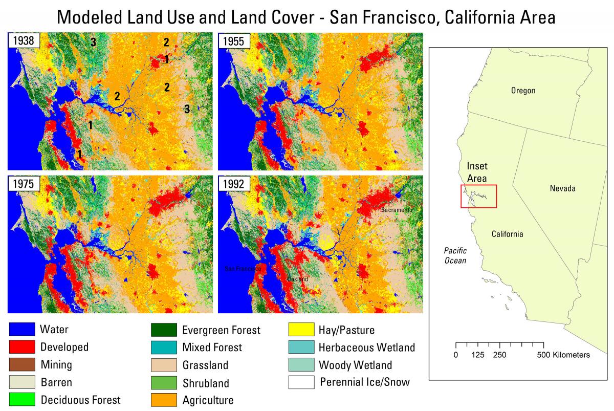
Land use and land cover (LULC) in the United States has changed dramatically over the last century. With a changing landscape, natural processes have been forever altered, impacting climate, carbon, hydrology, biodiversity, and other ecosystem services. An understanding of historical LULC is needed to assess the past effects of LULC change on ecological and societal processes, and to facilitate the modeling of potential future LULC change to support planning and mitigation efforts. Multiple contemporary, spatially explicit LULC databases are available for the conterminous United States at moderate spatial and thematic resolutions, including the National Land Cover Database, LANDIRE, and the USGS Land Cover Trends project. However, these data rely on remote sensing data and are unavailable for dates prior to the initiation of Landsat. There are no historical, spatially explicit, consistent LULC databases available for the conterminous United States.
To meet the need for historical LULC data, staff at the USGS Earth Resources Observation and Science (EROS) Center have used a modeling approach to produce historical LULC maps back to 1938 for the conterminous United States. Historical remote sensing databases were combined with Agricultural Census data, demographic histories, a database of reservoir construction dates, county-level wetland drainage histories, and other historical data to construct historical “demand” back to 1938. Demand essentially provides a prescription for the quantities of historical LULC change at annual time steps at a regional level, with U.S. Environmental Protection Agency (EPA) ecoregions serving as the spatial framework. A spatial allocation component within the FOREcasting SCEnarios of land use change (FORE-SCE) model ingests quantitative demand at a regional level and produces a spatially explicit representation of the prescribed proportions of LULC change.
The resulting product is an annual, spatially explicit LULC database for the conterminous United States from 1938–1992, with 15 distinct LULC classes mapped at 250-m resolution. The data are designed to be consistent with existing modeled land cover data from 1992–2100, produced as part of the USGS LandCarbon project. Combined, the two datasets provide truly unique, spatially explicit, annual “snapshots” of LULC conditions across the conterminous United States from 1938–2100, with four alternative future scenarios for the years 2006–2100. The unique nature of these data makes them suitable to assess the relationship of LULC change with a wide variety of ecological processes. With data now available for both historical and future time periods, researchers can assess historical LULC change processes, determine historical impacts on ecosystem services, and use the future scenarios to determine potential future impacts, facilitating mitigation and planning efforts. Land cover modeling results discussed here are available at http://landcover-modeling.cr.usgs.gov.
http://landcover-modeling.cr.usgs.gov

Modeled land use and land cover from 1938–1992 in the San Francisco, California, area. The inset area is approximately 125 x 90 miles.

