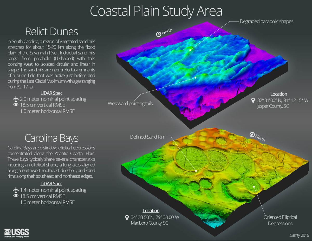
Lidar technology is revolutionizing the field of geological mapping, leading to discoveries in a variety of related disciplines. As lidar acquisitions become more readily available, researchers have incorporated lidar-derived products in their analyses to precisely map features like active faults, landslides, sinkholes, flood inundation, surficial deposits, and the extent of bedrock geologic units. One such mapping initiative being conducted by the USGS delineates surficial deposits of wind-blown sand in the Atlantic Coastal Plain from western Georgia to central North Carolina. This area is known for having a complex geological history, and numerous questions regarding the origin of its surficial sand deposits remain unanswered. Lidar-derived elevation models allowed researchers to analyze landforms in much greater detail and discover features too subtle to be discerned in the field. Models reveal swaths of low-profile landforms, such as relict dunes and Carolina Bays, in striking detail. Geologic mapping efforts in this area are leading to better management of the Carolina Sandhills National Wildlife Refuge and improved understanding of relations between geology, paleoclimate, soils, and biology. Lidar data for this study were acquired by the South Carolina Department of Natural Resources (SCDNR) between 2008 and 2012. Data and descriptions of acquisitions are available via the National Map 3D Elevation Program and the SCDNR.

Lidar-derived elevation models in the Atlantic Coastal Plain.

