The USGS is applying satellite remote sensing resources and expertise to quantify evapotranspiration (ET) for the National Water Census and WaterSMART (Sustain and Manage America’s Resources for Tomorrow) initiative. Work developed at the USGS Earth Resources Observation and Science (EROS) Center is focused on understanding and quantifying the spatial and temporal distribution of water consumption, i.e., water that is used by the soil and vegetation complex and returned to the atmosphere in the form of evaporation and transpiration, which makes it unavailable for other uses. The USGS works collaboratively with stakeholders to enable powerful technical capabilities within a geographical context by targeting efforts in watersheds or basin-level Focus Area Studies, where the resulting tools and information can soon become the basis for monitoring and assessing water use across the Nation.
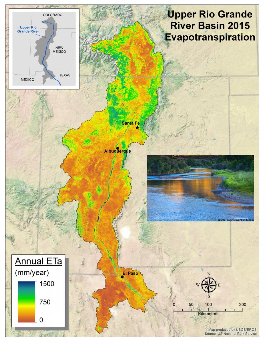
Changes in climate, land use, and water demand are placing increased pressure on the Upper Rio Grande Basin’s (URGB) limited water resources, necessitating careful water management decisions. Accordingly, in collaboration and coordination with the USGS New Mexico Water Science Center, maps of estimated water use were created for the 2015 growing season in the URGB using freely available Landsat thermal (infrared) imagery and weather data. By planning today for water tomorrow, this work helps to ensure the research is timely and relevant in a regional and national context.
Determining remotely sensed ET and agricultural consumptive use from Landsat allows for temporal evaluation with a critical spatial component to see trends at the level of individual fields and across entire landscapes. Water use maps can allow insight into crop-specific productivity, drought implications, and water budget analyses, which can include surface and groundwater, and environmental flow. The USGS EROS develops and shares these ET products with USGS Water Science Centers that are responsible for compiling water use data every 5 years. Similarly, researchers at the North Central Climate Center and the Bureau of Reclamation are evaluating these products for their usefulness for continual scientific analyses and agro-hydrologic modeling.
http://water.usgs.gov/watercensus/

2015 Annual Evapotranspiration Map of the Upper Rio Grande River Basin.

