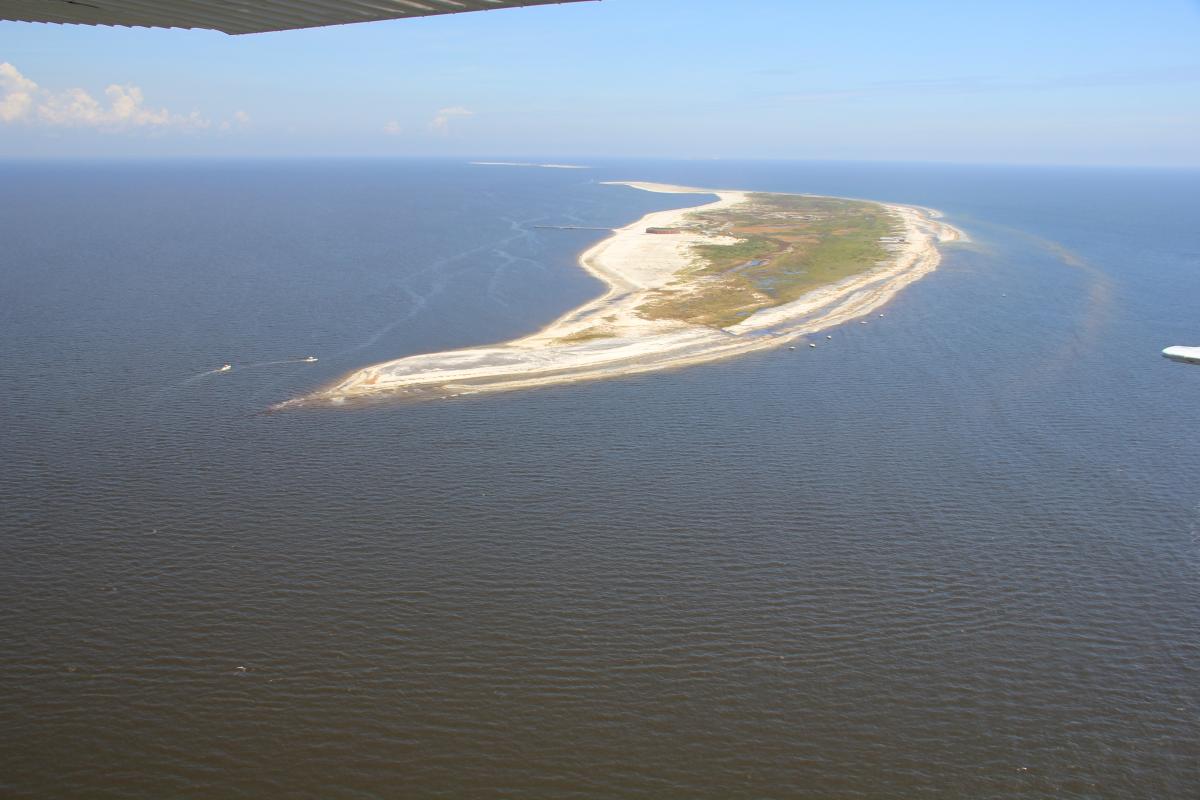
Restoration of coastal ecosystems has emerged as a high priority management issue because these lands, which are highly vulnerable to climate change, provide valuable ecosystem services. The Mississippi barrier islands are dynamic coastal landforms that are the first line of defense between the Gulf of Mexico and the Mississippi mainland coast. These islands are experiencing changes in structure (land area and habitat) and geomorphic processes (erosion and accretion) due to frequent intense storms, relative rise in sea level, and changes in sediment supply. Long-term loss of the barrier islands threatens the highly productive Mississippi Sound estuarine ecosystem and exposes the mainland Mississippi coast and its associated habitats to increasing saltwater intrusion and damage from future tropical storms. To reduce the risk for vulnerable areas, under the Mississippi Coastal Improvements Program (MsCIP), the U.S. Army Corps of Engineers (USACE) is investing in barrier island restoration at Ship Island through direct sand placement of approximately 22 million cubic yards to restore island structure and enhance sand supply to the littoral (tidal) transport system. Construction associated with the Ship Island restoration is scheduled to begin in February 2017.
A long-term monitoring and adaptive management (MAM) program is being integrated into the MsCIP barrier island restoration project. The incorporation of a science-based approach into the large-scale restoration effort includes the development of a conceptual ecological model, the identification of risk and uncertainties, performance measures, objectives, success criteria, monitoring parameters, and potential adaptive management actions. Throughout the restoration project life cycle, the MAM calls for several remote sensing activities. One activity is detailed mapping of barrier island habitats (i.e., submerged and emergent wetlands, tidal flats, beach, dune, etc.) before restoration (i.e., baseline mapping effort), during, and after restoration. The MAM also calls for the use of geospatial data such as satellite imagery, aerial imagery, and topobathymetric data to assess and monitor changes to barrier island habitats and the resources they support (i.e., fish and wildlife such as gulf sturgeon, sea turtles, and shorebirds) as a result of the restoration activities. This MAM includes remote sensing efforts from the USGS Wetland and Aquatic Research Center and the USGS St. Petersburg Coastal and Marine Science Center.

Oblique aerial photograph of West Ship Island, Mississippi, from 2012. The island is almost 2,000 feet at its widest point. The view is easterly, with the mainland toward the left (Morgan and Westphal, 2016; http://pubs.usgs.gov/ds/0988/).

