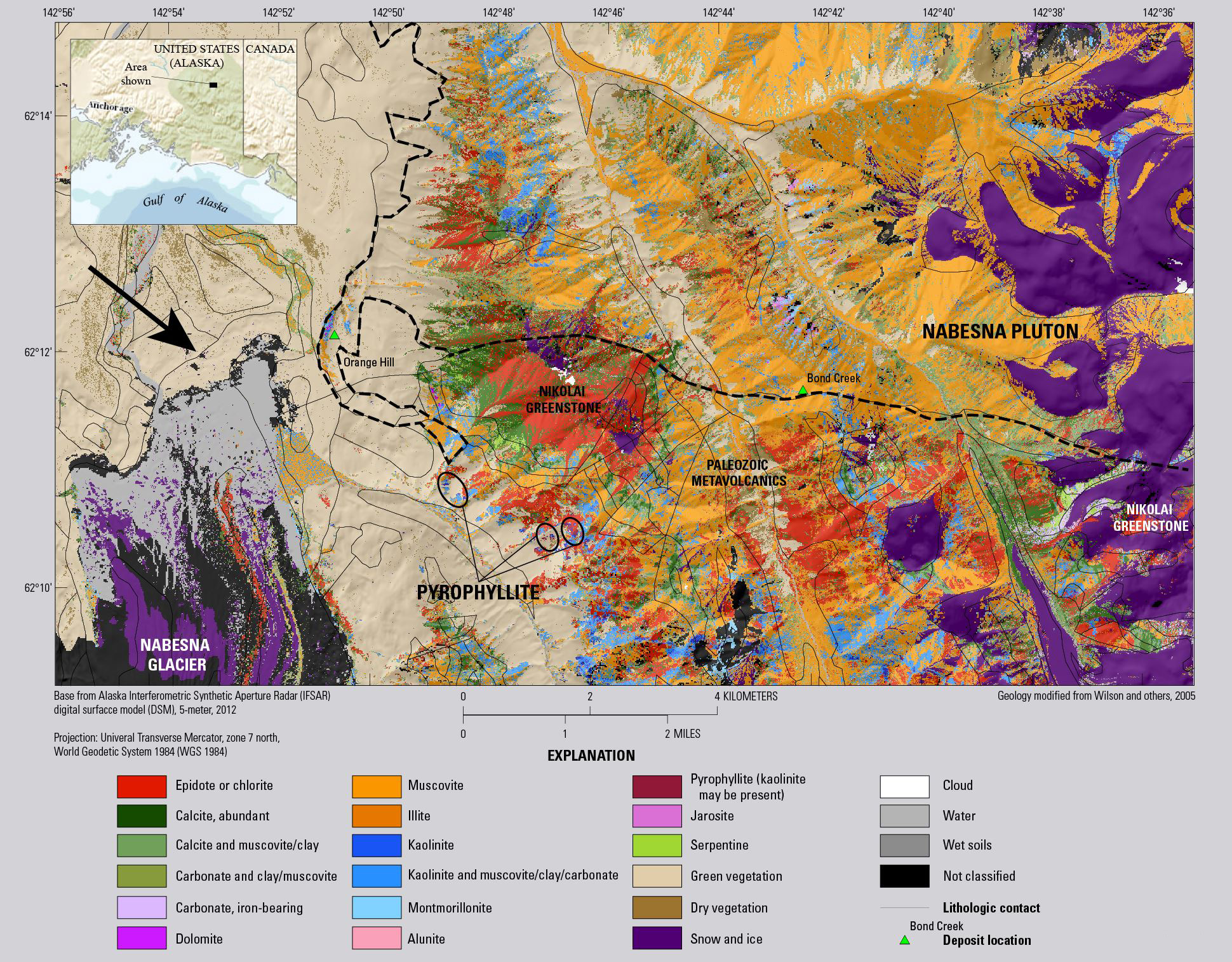
The USGS Mineral Resources Program (MRP) is using hyperspectral remote sensing at a variety of scales to characterize rocks and soils in selected areas of Alaska using laboratory, field-based, and airborne spectrometers. The advanced sensors can identify and map specific minerals. These mineral maps are being linked to geologic field surveys, rock samples, and chemical analyses to better characterize known deposits and identify prospective ground for additional mineral resources in steep, remote terrain. The airborne hyperspectral survey at a 6-m spatial resolution was conducted in July 2014 using HyVista’s HyMap imaging spectrometer to cover two large areas in Alaska, each greater than 1,000 km2. In July 2015, the USGS collaborated with the University of Alaska Fairbanks (UAF) to utilize their commercially purchased HySpex sensor in the field to image selected rock outcrops at very fine resolution (5-cm pixel size). In addition to the hyperspectral data, other remote sensing data are being used to characterize geologic materials, including Synthetic Aperture Radar (SAR), Advanced Spaceborne Thermal Emission Radiometer (ASTER), and high spatial resolution satellite data (3.5-m pixel size) acquired by Digital Globe’s WorldView-3 sensors. These activities are expanding capabilities in applying remote sensing data to characterize mineral resources.
http://crustal.cr.usgs.gov/projects/hyperspectral-AK-mineral-deposits/in...

Preliminary map of selected minerals for a portion of the Nabesna area of interest, near Orange Hill and Bond Creek deposits in Alaska. The image, derived from HyMap imaging spectrometer data collected in July 2014, is draped on shaded relief.

