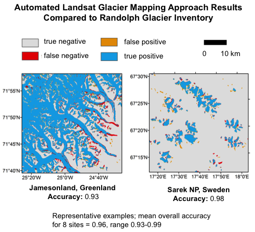
Remote sensing glacier mapping approaches have typically required a substantial time investment from image analysts to select appropriate cloud-free scenes, set threshold values for image classification, and correct misclassified pixels. This requirement has limited the areas where inventories of Landsat-derived glacier area are available, and it has limited the frequency of updates. A new fully automated glacier mapping approach developed at the Alaska Science Center considers all late summer cloud- and shadow-free land surface views acquired by Landsat over a 5-year period to identify pixels with glacier ice or perennial snow cover. The approach is made possible by the opening of the Landsat archive, the availability of atmospherically corrected Landsat surface reflectance data, and a new cloud masking approach optimized for use in areas with rock, snow, and ice—areas where existing cloud masking approaches have performed poorly. Testing across northern high latitude regions indicates good agreement with available data from existing glacier inventories. The newly developed approach has the potential to facilitate consistent glacier mapping and monitoring across large regions where such efforts have previously been limited or absent.

Comparison of automated Landsat glacier mapping approach results with Randolph Glacier Inventory maps from the same time period for two study areas. Results from these and six additional study areas indicate good agreement, demonstrating the effectiveness of the fully automated approach.

