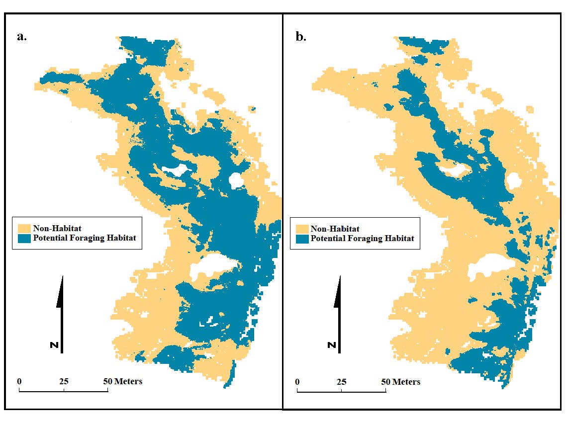
Lidar can be problematic for mapping topography of coastlines because it is infeasible to fly large areas during short low-tide intervals and capture intertidal coverage. As an alternative, USGS and Oregon State University researchers used terrestrial laser scanning (TLS) at an Oregon rocky intertidal site to investigate potential changes in foraging habitat for an obligate intertidal shorebird, black oystercatcher, using several sea-level rise scenarios. Researchers used TLS-derived topography to model and identify ideal oystercatcher foraging habitat. Simulated sea-level rise up to 1.2 m increased oystercatcher foraging habitat as more of the gentle-sloped rock became intertidal, yet at sea-level rise above 1.2 m this rock becomes fully submerged and foraging habitat disappears. Results highlight how the intertidal zone may respond differently from site to site and with amount of sea-level rise. Using TLS-derived topographic models can help assess how sea-level rise will affect coastlines at fine scales.
http://link.springer.com/article/10.1007%2Fs11852-014-0346-8

Mapped potential black oystercatcher foraging habitat with 1 m (a) and 2 m (b) sea-level rise at Rabbit Rock, Oregon.
Citation: Hollenbeck, et al (2014), Figure 9, p. 711.

