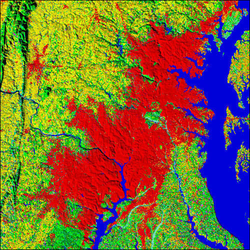
Researchers at the USGS have developed the FOREcasting SCEnarios of Land-Cover Change (FORE-SCE) model, which is based on consistent and systematic historical data derived from Landsat imagery of rates and spatial patterns of land cover change over many years. As part of USGS research to assess potential greenhouse gas fluxes and carbon storage in vegetated landscapes, FORE-SCE has been used to produce projected, annual land cover maps from 1992 through 2100 for four future scenarios for the conterminous United States. The land cover maps provide 250 m resolution information for 17 different land use and land cover classes, offering an unprecedented combination of thematic detail and spatial resolution for land cover projections.
Four land cover scenarios were modeled based on carefully defined environmental scenarios from the Intergovernmental Panel on Climate Change (IPCC), ensuring that the projected land cover maps may be used in assessment frameworks consistent with IPCC scenario characteristics. The scenarios vary in terms of both climate and socioeconomic conditions in the future.
FORE-SCE is also being used to produce “backcast” historical land cover maps for the conterminous United States. Historical data sources such as population census data, historical agricultural census data, wetland change inventories, and forest databases are used to parameterize (i.e., set design limits on) FORE-SCE and produce annual land cover maps going back to 1938. These data are spatially and thematically consistent with the future projected land cover scenarios. The result is a seamless, consistent set of annual land cover maps from 1938 through 2100, at 250 m resolution and with 17 land cover classes. Backcast land cover data for the conterminous United States will be completed in 2015.

A projection of developed land (red) in the Baltimore-Washington area in 2050.

