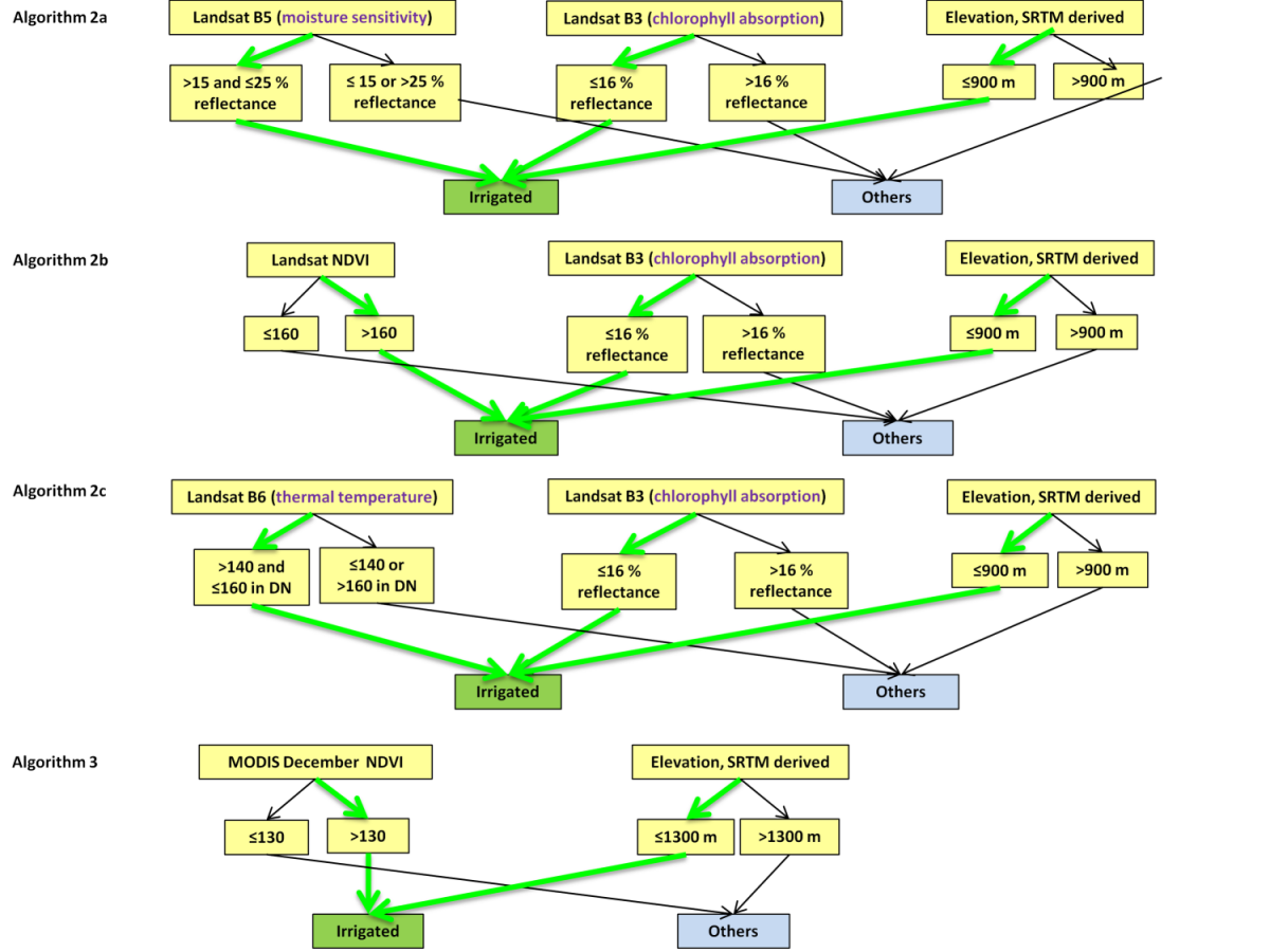
The overarching goal of this research was to develop and demonstrate an Automated Cropland Classification Algorithm (ACCA) that accurately classifies agricultural croplands extent, identifies irrigated versus rainfed crops, and computes area statistics over large areas through a combination of multi-sensor remote sensing and secondary data. ACCA was developed in support of WaterSMART (Sustain and Maintain America’s Resources for Tomorrow). Currently, ACCA is developed for Tajikistan (Thenkabail and Wu, 2012) and the State of California (Wu, Thenkabail and others, 2013).
Automated Cropland Classification Algorithm example for Tajikistan. Numerous such rules are developed to complete the algorithm for an area.
Thenkabail P.S., Wu Z. An Automated Cropland Classification Algorithm (ACCA) for Tajikistan by Combining Landsat, MODIS, and Secondary Data. Remote Sensing. 2012; 4(10):2890-2918.
Wu, Z.,Thenkabail, P.S., and Verdin, J. 2014. An automated cropland classification algorithm (ACCA) using Landsat and MODIS data combination for California. Photogrammetric Engineering and Remote Sensing. In Press. January 2014 issue.
Wu, Z., Thenkabail, P.S., Zakzeski, A., Mueller, R., Melton, F., Rosevelt, C., Dwyer, J., Johnson, J., Verdin, J. P., 2014. Seasonal cropland mapping using the Automated Cropland Classification Algorithm (ACCA). Journal of applied remote sensing (JARS). In review.
Download the paper at: http://www.mdpi.com/2072-4292/4/10/2890
The ACCA algorithm is available at: https://powellcenter.usgs.gov/globalcroplandwater/content/models-algorithms


