Federal public lands in the western United States are becoming increasingly surrounded by Gateway Communities. "Gateway Communities” are communities that are adjacent to or near Federal lands and serve as an entry point for visitors to Federal lands. These communities are undergoing landscape change due to population growth, economic growth, and the resulting land use development. Gateway Communities will be selected as study sites for monitoring urbanization intensity and density, urban encroachment on adjacent Federal lands, and public land recreational demands.
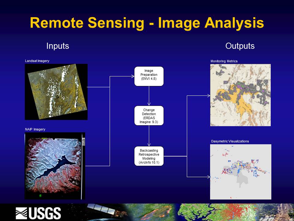
The project implemented an integrated approach to remote sensing, combining multiple sources of imagery, specifically NAIP high-resolution historical aerial photography, moderate resolution Landsat 5 and 7 satellite imagery, and related NLCD geospatial data. A “backcasting” methodology was applied to population distribution dasymetric mapping techniques to generate a retrospective land-use time series designed to map and monitor urban, suburban, and exurban land-use changes within Micropolitan Statistical Areas and western U.S. Gateway Communities.
Process flow diagram illustrating the use of Landsat and National Agriculture Imagery Program imagery as input data sources for mapping and monitoring Micropolitan Statistical Area land use change.


