The USGS Eastern Geographic Science Center (EGSC) is conducting process-based hydrologic, biologic and climate modeling to demonstrate the utility of those data in particularly challenging or scientifically important regions of the eastern United States, and to improve hydrologic, biologic, and climate modeling. Studies include the characterization of surface water extent and vegetation phenology. An understanding of surface water dynamics is critical to climate, hydrologic, and biologic research and resource management. The extent of water on land surfaces varies greatly within and across years. At the global scale, there is interest in monitoring surface water extent (SWE) and heights for large water bodies; however, only low-resolution data can cover large areas. Resource managers require surface water dynamics information with high spatial and temporal resolution. Techniques to derive and apply surface water dynamics information have not kept pace with the capacity to capture high resolution data from both passive and active remote sensing systems. EGSC is also developing advanced data mining, fusion, and evaluation techniques to extract biophysical information from remotely sensed data. Further research is needed to develop methods of data fusion and information extraction from Landsat and other sensors to provide high spatial and temporal resolution surface water dynamics information needed for climate science, hydrology, biologic modeling and land/water resource management.
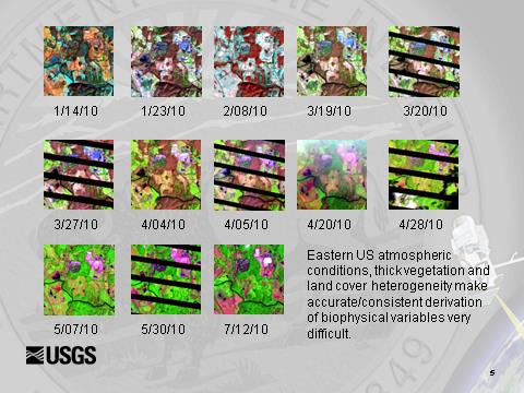
Advanced evaluation techniques are being developed to derive biophysical variables from remotely sensed imagery in the eastern United States.
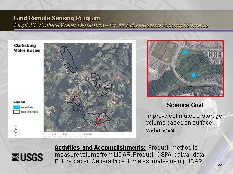
Improved measures of surface water dynamics are critical for effective climate, hydrologic, and biologic research as well as resource management.
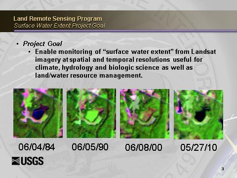
Techniques to monitor and model surface water extent from Landsat imagery highlight its temporal variability.


