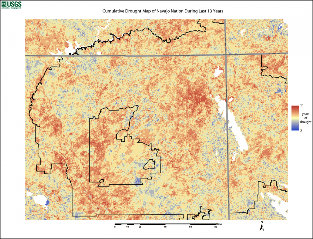
This research utilizes a combination of in situ and remote sensing technologies and algorithms to monitor the changing landscape of the Navajo Nation due to climatological influences. The Tribal land, equivalent in size to the State of West Virginia, is the least instrumented and least climatologically studied area of the United States. Landsat, MODIS and GOES imagery, GPS, terrestrial lidar data, weather station data and time-series imagery are being combined and correlated to develop novel remote sensing algorithms to determine drought impact and severity, dust storm vulnerability, and sand dune mobility. These methodologies are intended to help the Navajo Nation and the surrounding region better assess and plan for impacts of climatic change on the reservation.
Image depicting the areas of the Navajo Nation affected by drought. Each pixel in the image is color coded according to how many years of below normal vegetative growth have occurred over the past 13 years. Most severely affected areas, colored red, have had below normal growth for 11 out of 13 years.


