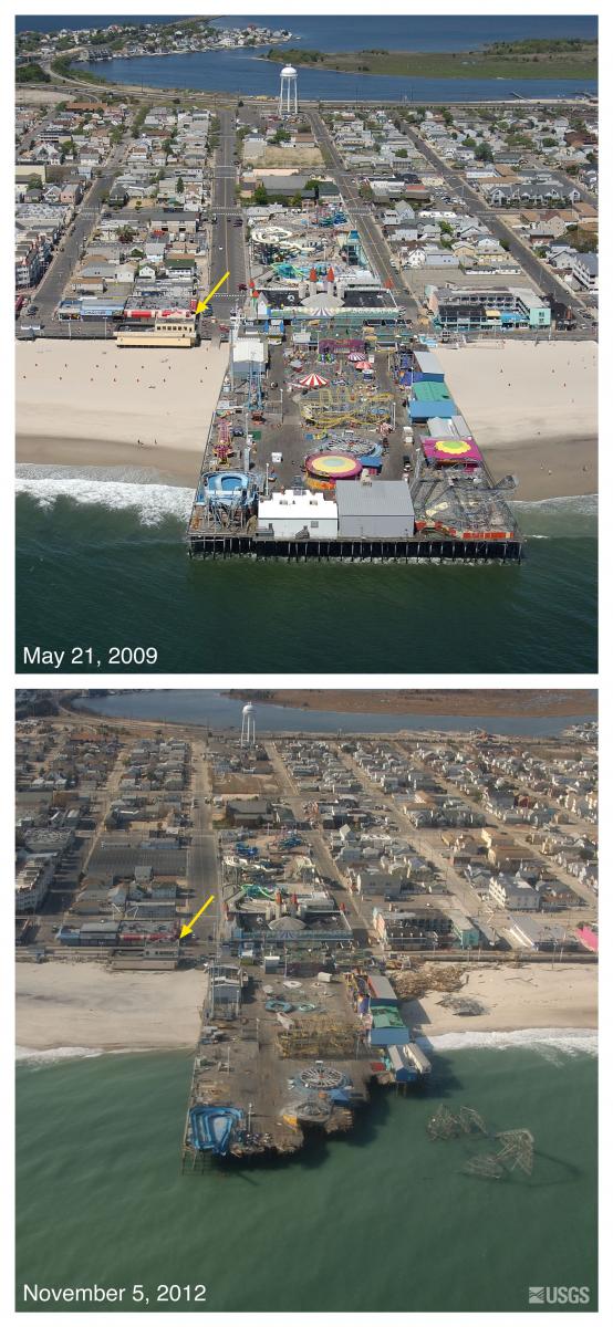
Oblique digital photography was collected along the coast in the aftermath of Hurricane Sandy from Montauk Point, New York, to Cape Lookout, North Carolina, from November 4 through November 6, 2012. The imagery allowed scientists to document and assess the damage caused by the storm, capturing the scope of the event throughout the entire impact zone. The data were collected using a Nikon D1X digital camera, while flying along the coastline at an elevation of 500 feet and about 1,000 feet offshore. The platform used for this flight was a Piper Navajo Chieftain. GPS data collected during the flight allowed geolocation of the imagery.
Collection of the post-Sandy imagery is part of an on-going effort to document the effects of severe coastal storms. More than 43 flights during the past 17 years have documented both pre- and post-storm conditions along the coast. This imagery is used to analyze conditions following a storm, to help direct responders and researchers to areas of high impact after a storm, and to inform the public of the impact of the storm, through the USGS Website, and often before people are able to return to their property.
http://coastal.er.usgs.gov/hurricanes/sandy/
Oblique aerial photographs of Seaside Height Pier, New Jersey. View looking west towards shore. Storm waves and surge eroded the beach and destroyed the seaward edge of the pier and deposited the roller coaster superstructure in the ocean. Sediment deposited on the island is visible in the background and indicates that overwash occurred here. The yellow arrow in each image points to the same feature.


