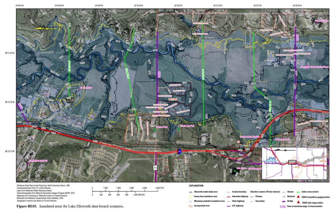
Dams provide beneficial functions such as flood control, recreation, and water supply, but they also entail risk. The State of Oklahoma requires each owner of a high-hazard dam to develop an emergency action plan that includes a hydraulic model simulation and inundation maps for a flood resulting from a possible dam breach. An area of concern lies near the City of Lawton, Oklahoma. A dam breach at Lakes Ellsworth or Lawtonka would affect military facilities, water treatment plants, wastewater treatment plants, recreational areas, and community-services offices. Accurate topographic data are vital for developing flood inundation maps, so the USGS, in cooperation with the City of Lawton, collected airborne lidar data that were used to develop a high-resolution digital elevation model and a 1-foot contour elevation map for the low-lying areas downstream from Lakes Ellsworth and Lawtonka. This digital elevation model and field measurements of bridges and streamflow were used as inputs for the hydraulic model simulations. Water-surface profiles were developed for maximum flood-inundation elevations and flood-wave arrival times for selected bridge crossings.
http://pubs.usgs.gov/sir/2012/5026/
 Modeled inundated areas in Lawton, Oklahoma, derived from aerial lidar elevation data, for Lake Ellsworth dam-breach scenarios.

