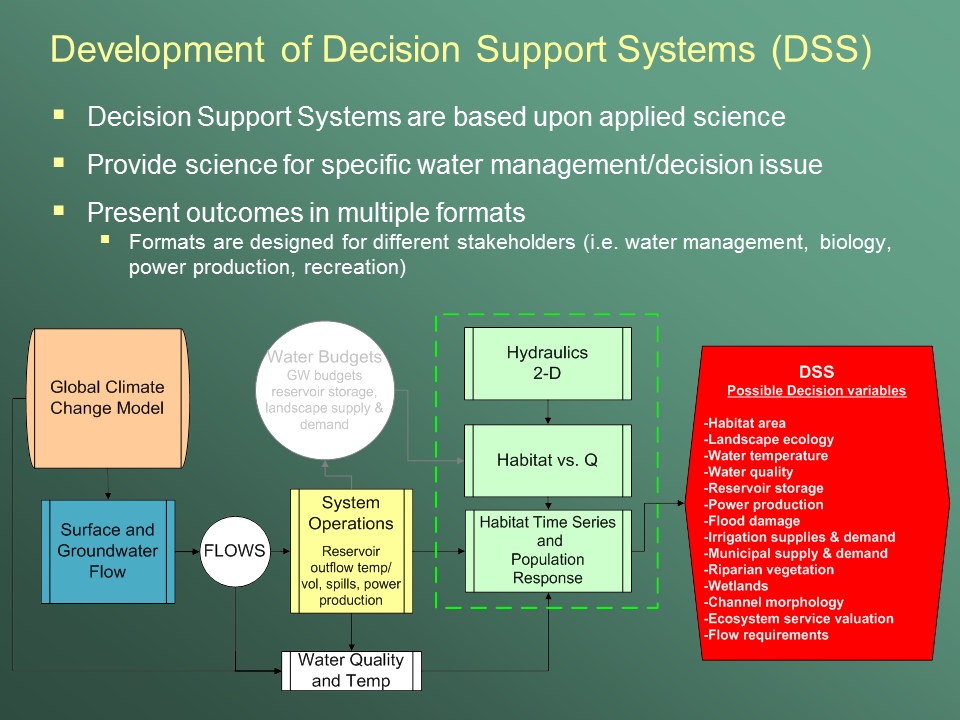
Effective river management depends not only on scientific understanding of the many interacting components of river systems, but also on how well that information is accessed, communicated, and used in decision processes. Therefore, one emphasis at the USGS Fort Collins (FORT) Science Center is acquiring and conveying scientific information and analyses in forms that are relevant to legal and institutional decision processes. FORT’s development of a prototype Decision Support System (FORT-DSS) allows simultaneous views of river hydraulics, species-specific habitat, and fish population simulations. The FORT-DSS used existing datasets from the Upper Delaware River to develop a multi-layered geographic information system (GIS) that resource managers can use to better understand the complex ecological interactions of river ecosystems and thus make better-informed management decisions.
The following data layers were integrated into one geospatially referenced database: physical river measurements (topography, flow, temperature, and geolocation), habitat characterization and location, species life history, and background aerial imagery. Visualization products were also developed to display the information to resource managers. Further model development is expected to apply the FORT-DSS to additional river systems and validate its outputs with existing datasets.
 Example flowchart of DSS model linkages, processes, and possible decision variables.

