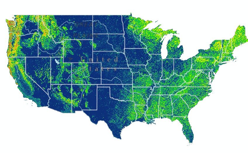
A preliminary height-above-ground (HAG) model utilizing over 350 billion light detection and ranging (lidar) points and Web-enabled Landsat Data (WELD) was created to predict heights based on an annual composite of 2009 Landsat data. A comparison of the predicted heights at 30-meter resolution compared to mean heights computed from lidar yielded promising results (r2 = 0.69, root mean square error (RMSE) of 4.1 meters). Further refinements of this model are planned for fiscal year 2014 to determine extensibility to other time periods, incorporate new lidar data into the model, and reduce uncertainties. This model is being used to develop the USGS Biomass Essential Climate Variable product.
30-m height above ground model estimated by lidar/Landsat integration.


