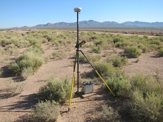
A terrestrial gravity-monitoring study to estimate aquifer storage change is using GPS to precisely locate relative-gravity monuments and permanently installed gravimeters. Because relative-gravity monuments can be located precisely each time a survey is done, they can be small, non-permanent installations, as shown in the photo of the relative gravity meter and GPS unit. This installation is ideal for short-term or repeat-measurement monitoring projects. Continuous GPS data currently provide vertical control for a superconducting gravimeter making continuous measurements. This gravimeter is located at a semi-permanent installation adjacent to a recharge basin; because the basin is flooded and then drains, measurable subsidence occurs. These vertical fluctuations can then be removed from the gravity data to more precisely monitor ongoing recharge.
A GPS unit and a relative gravity meter are set up on a non-permanent relative gravity station adjacent to a Tucson Water recharge pond (located behind the fence in the background) near Tucson, Arizona. The source of the recharge is the Colorado River; water is moved through the Central Arizona Project aqueduct from Lake Havasu to the Phoenix and Tucson areas.
http://az.water.usgs.gov/projects/HydroGravityMonitor/index.html


