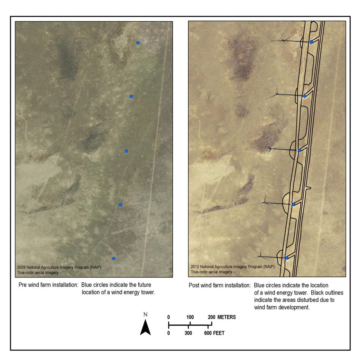
Managing land use change and disturbance with regard to energy development in Wyoming is increasingly more important. The explosion of oil and gas development, mining activities, and wind energy development on private and public lands has exponentially increased over the last 11 years. Wyoming is considered one of the centers of wind development. Erecting wind turbines requires additional infrastructure development on the landscape, including road development or widening, substations, above and below ground utility lines, meteorological stations and communication towers. Mapping these disturbances is necessary to properly assess direct and indirect implications of such developments, and inform policy and management decisions. This on-going effort utilizes 2006, 2009, and 2012 NAIP true-color aerial imagery to identify disturbance area and type associated with wind energy development. Where possible, assessments of changes in disturbance over time are being captured to better assess immediate versus long-term disturbances. Disturbances across each wind farm are also being examined allowing identification of potential best management practices that could minimize impacts.
Wind farm sites before and after installation. Disturbance types include new roads, widening of existing roads, substations, above and below ground utility lines, meteorological stations, communication towers, and wind tower pads.


