Using remote sensing and non-remote sensing approaches, this research presents an exhaustive overview of global croplands and their water use. Global cropland area estimates from different studies are quite close and range between 1.47–1.53 billion hectares. However, significant uncertainties exist in determining irrigated areas that consume nearly 80% of all water used by humans. The estimates show that the total water use by global croplands varies between 6,685 to 7,500 km3 per year, and of this total, around 4,586 km3 per year is consumed by rainfed croplands (green water use) and the rest is consumed by irrigated crops (blue water use). Irrigated areas use about 2,099 km3 per year (1,180 km3 year of blue water and the rest from rain that falls over irrigated croplands). However, 1.6 to 2.5 times the blue water required by irrigated croplands is actually withdrawn from reservoirs or groundwater, suggesting an irrigation efficiency of only between 40–62%. The weaknesses, trends, and future directions to precisely estimate the global croplands are examined. Finally, the research links global croplands and their water use to a paradigm for ensuring future food security.
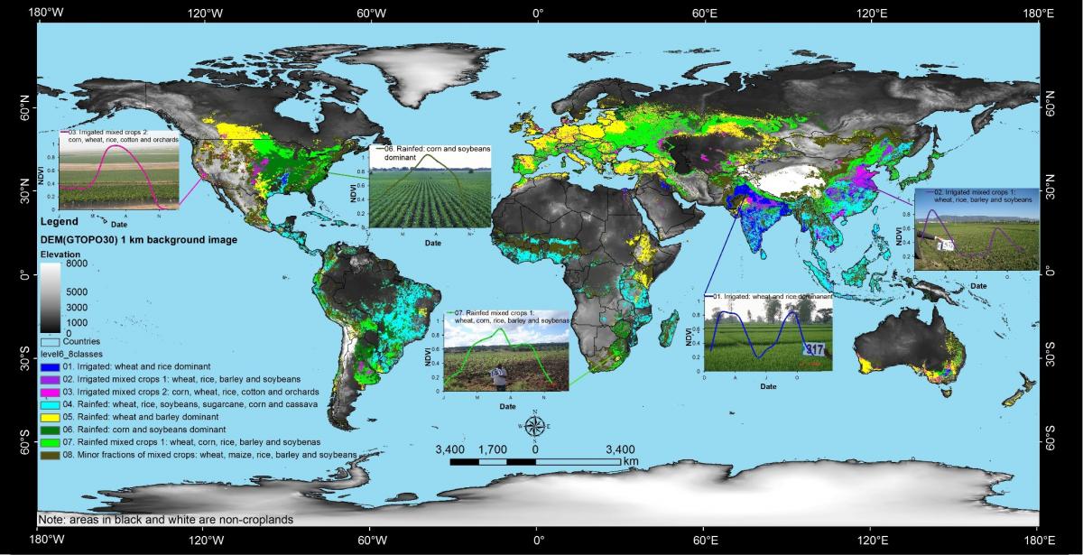
Global croplands from remote sensing spatial distribution of global cropland extent along with their crop dominance at nominal 1-km resolution using AVHRR and SPOT VGT images combined with numerous secondary data such as temperature, precipitation, and SRTM-derived elevation.


