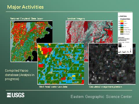
Agricultural irrigation is a primary use of fresh water in the United States. It is difficult to accurately quantify the amount of water used for irrigation at large spatial scales. Remote sensing has been successfully used to map the amount of land under irrigation through time, particularly in arid regions. However, operational use of remote sensing to quantify water use for irrigation has not yet been realized. In addition, in the eastern United States relatively lush non-agricultural vegetation cover, humid conditions, and smaller patch sizes of agricultural fields pose additional challenges for mapping irrigated land and to estimate water use through irrigation. The USGS Eastern Geography Science Center is exploring the combination of remotely sensed and detailed ground-based data to estimate water use for irrigation on intra-annual time scales in the East. The research leverages USGS remote sensing expertise and local knowledge of irrigation practices to develop and improve tools for water resource management.
Integrating ancillary data with imagery to estimate irrigated water use


