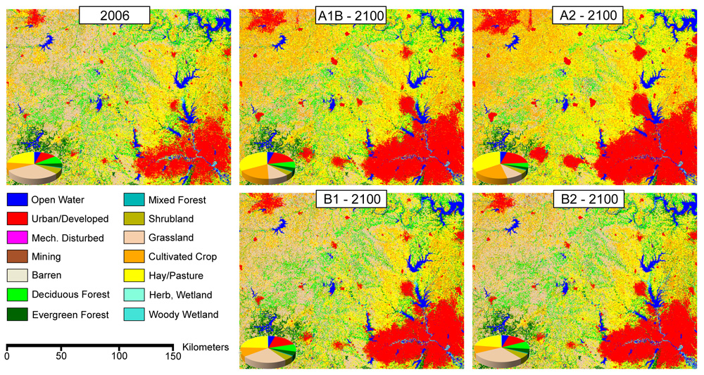
USGS scientists have long used remote sensing imagery to map historical and current land cover. USGS land cover databases were used in an assessment of future potential landscape change. In support of a USGS assessment of ecosystem carbon sequestration and greenhouse gas fluxes, USGS scientists have produced annual land cover projections from 1992 through 2100 for the conterminous United States. Four Intergovernmental Panel on Climate Change (IPCC) Special Report on Emissions Scenarios (SRES) were modeled using the USGS Forecasting Scenarios of Land-use Change (FORE-SCE) model. The land cover projections relied heavily on historical land-cover databases, with information on the rates, types, and spatial characteristics of land cover change to parameterize the FORE-SCE model. The relatively high thematic and spatial resolution of the projected land cover maps facilitates their use for a variety of ecological assessments, allowing land managers and planners to assess the impacts of potential future land cover change on biodiversity, carbon and greenhouse gas fluxes, hydrology, regional weather and climate, and other ecological processes.
Year 2100 land cover projections for four IPCC scenarios near Dallas, Texas. Both "B" scenarios maintain much of the current natural land cover, while “A” scenarios increase cultivated crops, hay/pasture, and urban land with decreases in natural cover types.


