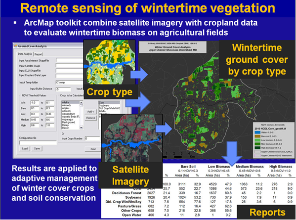
Cover crops have been shown to be effective in reducing nutrient and sediment losses from farmland, and planting of winter cover crops is a critical agricultural conservation practice in the Chesapeake Bay region. However, due to variable amounts of growth and biomass accumulation, the implementation of cover crops on working farms shows varied success in protecting water quality. USGS scientists have developed methods and tools to support a satellite-based remote sensing assessment of wintertime agricultural ground cover. Data integration is used to match satellite-based measurements of biomass (from Landsat) and crop type (U.S. Department of Agriculture (USDA) National Cropland Data Layer) with site-specific agronomic information, providing information that can support tracking and adaptive management of agricultural conservation practices in Chesapeake Bay watersheds.
Satellite imagery being used extensively in the Chesapeake Bay watershed to map winter ground cover


